Mubarak Al-Kabeer Port, Kuwait: designing a resilient mega port
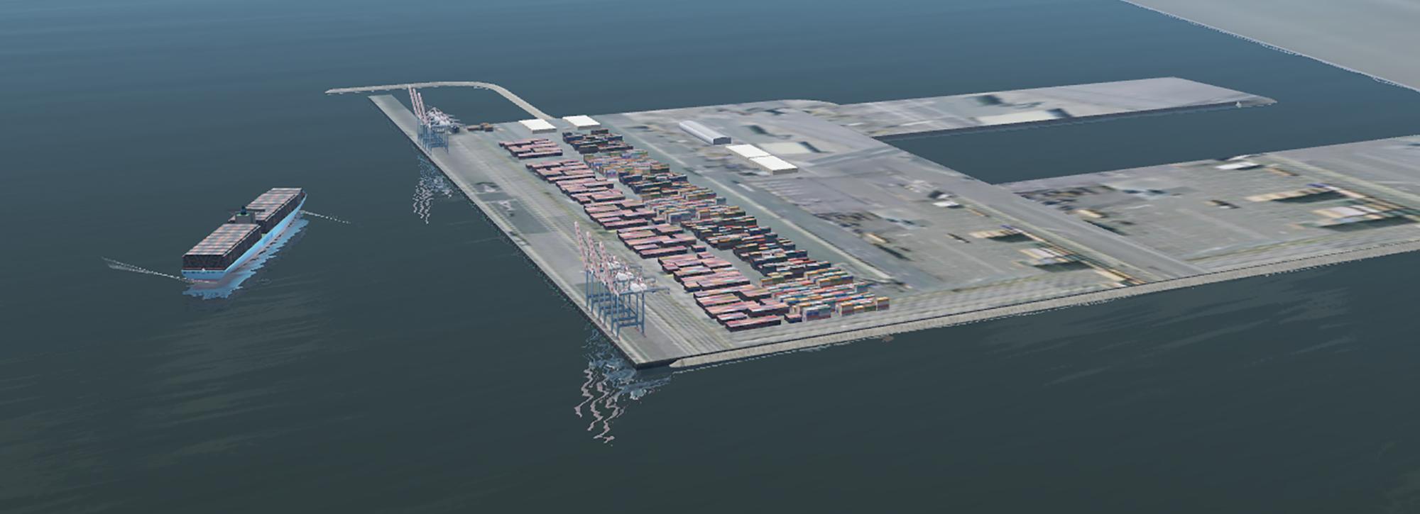
HR Wallingford has supported the development of Mubarak Al-Kabeer Port since 2006, helping shape a major new port on Boubyan Island. Through integrated modelling and long-term insight, the work has reduced sedimentation risk, improved navigation safety and supported sustainable, efficient port operations.


Planning a major port within a sensitive coastal setting
Mubarak Al-Kabeer Port forms part of a wider master plan for Boubyan Island, Kuwait’s largest island and an area of high environmental sensitivity. Large-scale infrastructure is planned alongside protected habitats, with around half the island designated as a nature reserve.
The port is being developed on soft sabkha mudflats, with little historic data available to inform design. At the same time, its coastal setting creates ongoing risks linked to sediment movement, navigation and long-term maintenance.
The project was needed to support economic growth and regional connectivity, while ensuring that development does not increase environmental risk or long-term operational costs. The priority was to create a port that can operate safely, efficiently and sustainably in a complex and changing coastal system.
Integrating modelling and insight to guide confident design decisions
HR Wallingford has worked with the client and delivery partners since 2006, supporting the port master plan and detailed design as it has evolved.
We combined numerical and physical modelling to understand how waves, currents and sediment interact across the site. We did this to reduce uncertainty and enable informed decisions on layout, dredging and long-term maintenance. This helped shape a design that works with natural processes rather than against them.
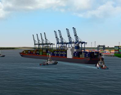
We analysed sediment transport to predict where material would accumulate and how this could affect operations. This allowed us to refine the port layout and reduce future dredging requirements. In parallel, we assessed vessel behaviour to ensure ships can manoeuvre safely in and around the port, both in open water and at berth.
Given the scale of the development, we extended modelling beyond the immediate site. We did this to understand wider coastal processes and how the port could influence them over time, supporting a more resilient design.
We also supported the design of a 50 km approach channel and link channel options, helping the client understand trade-offs between alignment, cost and performance.
More recently, we have helped evaluate a ‘sand barrier’ concept. We are using updated hydrodynamic and sediment transport models, calibrated with new field data, to test how effectively this approach could limit sedimentation within the port.
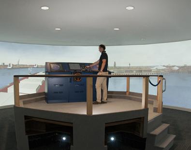
Alongside engineering studies, we developed a real-time navigation simulation facility. This allows pilots to train and test vessel movements before construction is complete, improving safety and operational readiness from day one.
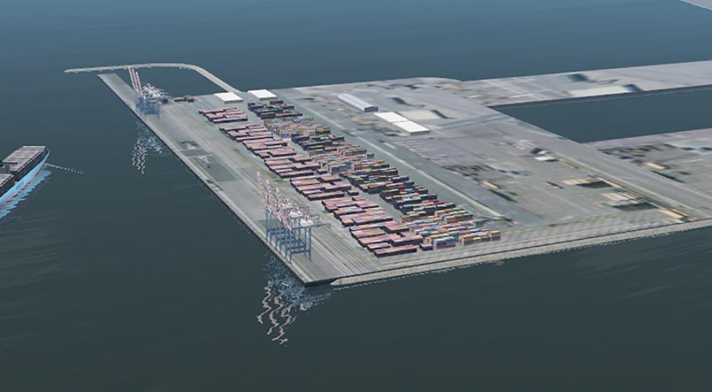
An overall master plan for Boubyan island, Kuwait's largest island
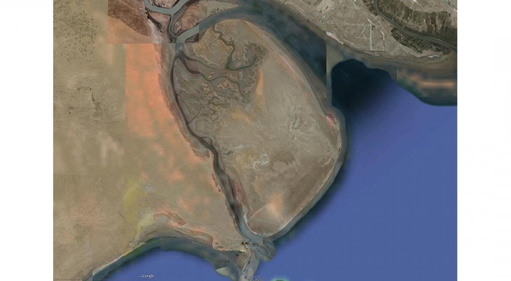
The port plan is part of an overall master plan for Boubyan island, the largest of Kuwait’s islands.
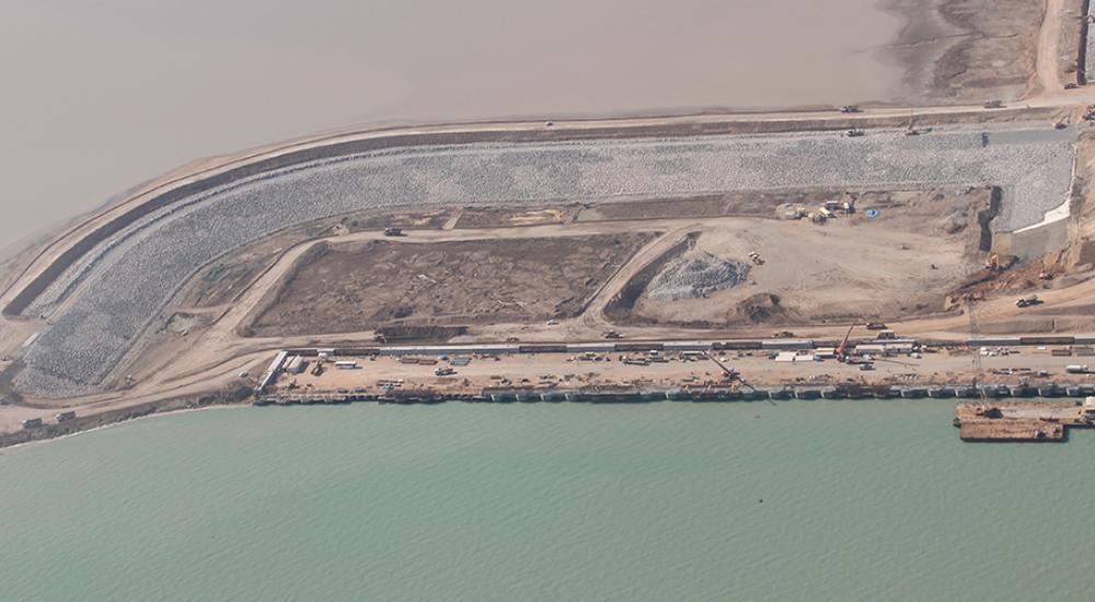
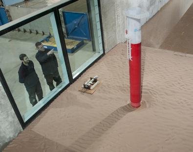
The small vessel harbour under construction within the reclaimed area
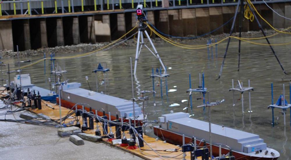
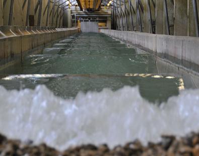
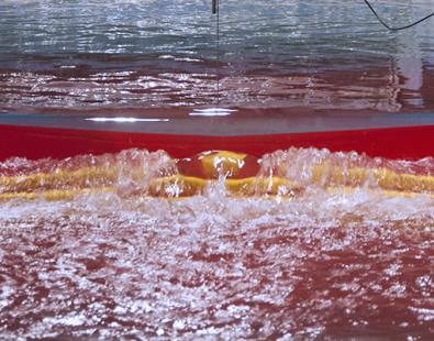
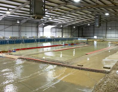
Our detailed studies including ship mooring analysis in our physical modelling facilities
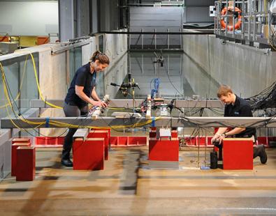
Navigation studies and innovative training in our ship simulation centre
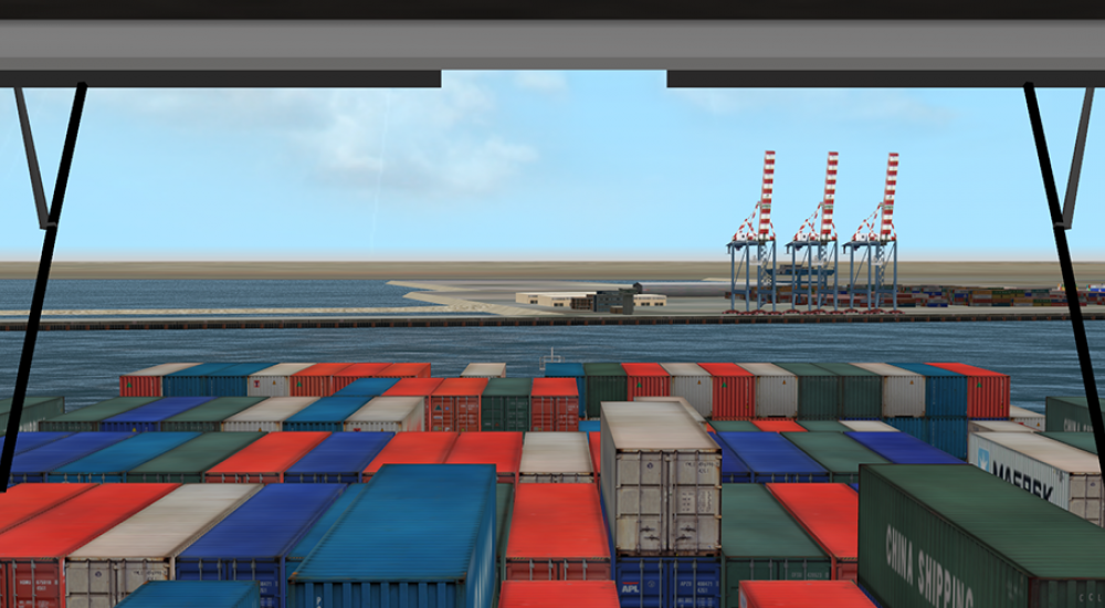
View from the bridge on our ship simulator.
Reducing risk, improving efficiency and supporting long-term performance
This work has helped create a port design that is better aligned with its environment and more efficient to operate over the long term:
- Reduced sedimentation and optimised layouts lower future dredging costs and support better long-term investment decisions
- Designing with natural processes helps minimise disruption to surrounding coastal and marine systems
- Improved navigation safety and early pilot training support safer operations, benefiting people working at and around the port
Together, these outcomes support reliable infrastructure that contributes to sustainable development while reducing risk and uncertainty.
Get in touch
John Baugh