Improving irrigation performance through sustainable sediment management in Georgia
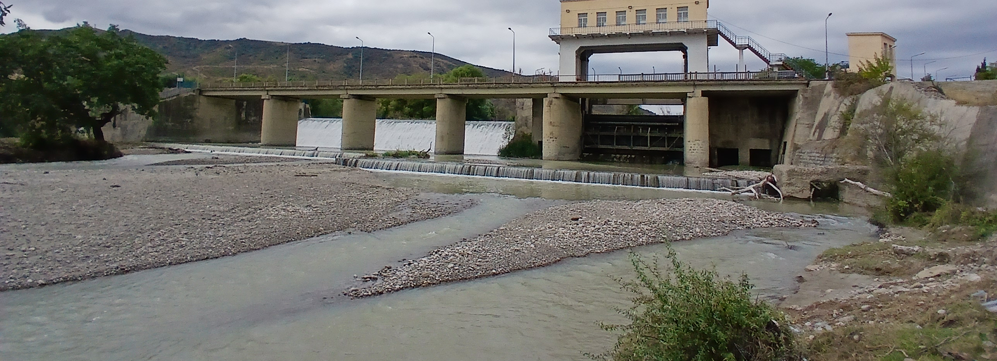
HR Wallingford helped modernise Georgia's Kvemo Samgori Irrigation System by identifying practical solutions to long-standing sedimentation problems. Through hydrological, sediment transport and operational assessments, we enabled investment decisions that will improve irrigation reliability, reduce maintenance requirements and support more productive agriculture across thousands of hectares.


Addressing sedimentation pressures in a vital irrigation system
The Kvemo Samgori Irrigation System (KSIS) is one of Georgia's most important agricultural water supply schemes, providing irrigation water from the Iori River to a large farming region in the country's east.
As part of the Government of Georgia's Resilient Agriculture, Irrigation and Land (GRAIL) programme, the system is being rehabilitated to improve water delivery, reduce losses and increase agricultural productivity. However, a major obstacle to achieving these goals was sediment entering the irrigation network.
A headworks structure built in the 1960s created an upstream pond that originally acted as a natural settling basin. Over time, sediment carried by the river almost completely filled the pond, reducing its capacity to trap material before it entered the irrigation canals. As a result, large volumes of sediment accumulated within the distribution network, reducing conveyance efficiency, increasing maintenance costs and restricting water delivery to farms.
With future irrigation demand expected to grow and climate change likely to increase pressure on water resources, a long-term sediment management strategy was needed to secure the system's performance.
Combining hydrological analysis with practical sediment management planning
HR Wallingford undertook a comprehensive assessment of the hydro-sedimentary processes affecting the irrigation system. Because long-term river monitoring data were limited, we developed hydrological models to reconstruct river flows at the intake and assess future conditions under different climate, land-use and water demand scenarios. We combined this with sediment investigations using reservoir sedimentation records, soil sampling and field surveys to quantify sediment loads entering the system.
We then evaluated a range of management options to reduce sediment ingress into the irrigation canals. Our analysis focused on restoring the original function of the headpond as a settling basin through targeted excavation. Alternative approaches, including construction of a dedicated desander structure, were also considered but we did not proceed with their detailed assessment due to lower flexibility and poorer value for money.
Using two-dimensional sediment transport modelling, we tested several excavation layouts under different operating conditions. This enabled us to compare sediment trapping performance, maintenance requirements and long-term operational implications, providing the client with a clear evidence base for decision-making.
In addition to helping the client to identify a preferred option, we provided technical support for implementation planning, including construction methods, maintenance strategies, environmental considerations and monitoring recommendations.
Layouts of the modelled options with proposed excavated levels
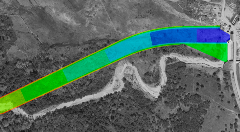
Layout 1
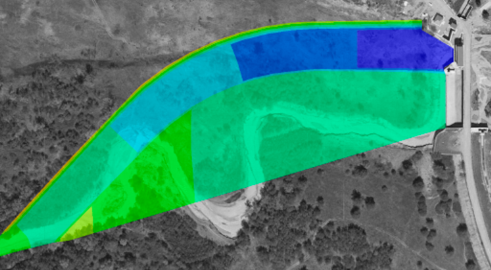
Layout 2
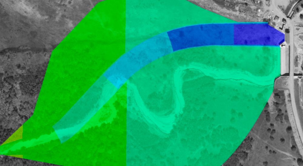
Layout 3
Supporting more reliable irrigation and resilient agricultural production
The study provided the information needed for the client to proceed confidently with the rehabilitation of the headpond and associated sediment management works.
The preferred option will significantly reduce the amount of sediment entering the irrigation network, improving water delivery efficiency and reducing the need for ongoing canal maintenance. This will help maximise the benefits of investment through the GRAIL programme and support more reliable irrigation for agricultural producers.
By restoring the system's ability to manage sediment naturally, the project provides a cost-effective and adaptable solution that can continue to perform as future demands and environmental conditions change.
The work supports sustainable water management, helping secure irrigation supplies, improve agricultural productivity and strengthen the resilience of farming communities that depend on the scheme.
Contact our project lead
Marta Roca Collell