The Thames Barrier – a gateway to innovation
Still one of London’s biggest ever infrastructure projects, the development of the Thames Barrier led to next level innovation in modelling. It also resulted in a survey campaign that has not been equalled in its scope since.
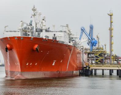
The work we did enabled HR Wallingford to become the go-to experts in modelling the tidal Thames – a legacy that continues to benefit our clients today. Over the years, our work has ranged from large multidisciplinary projects, such as London Gateway Port and Thames Tideway Tunnel, to tasks such as assessing small pontoons, or dredging practices.
How it all began
We began our association with tidal flooding in the Thames in the months following the devastating storm surge of 1953, back when HR Wallingford was still the Hydraulics Research Station (HRS).
The Waverley Flood Committee, appointed by the Government after the disaster to find solutions for the future, asked us to study the risks of storm surges to London. To start with we used an existing Port of London Authority (PLA) 1/3000 scale model of the estuary, housed in a disused PLA warehouse in Surrey Docks.
As a result of these early investigations, the Committee recommended examining whether a surge barrier in the Long Reach area of the estuary was viable. But progress over the following years was slow because it was difficult to strike a balance between protecting London and the impacts on navigation at Long Reach.
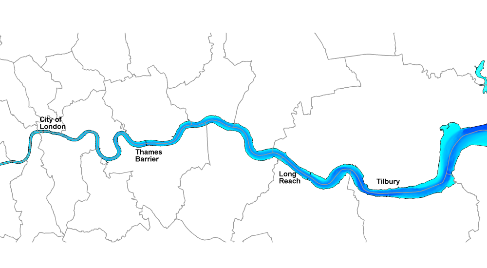
In 1966, Herman Bondi, a professor of mathematics at King's College, recommended that a barrage or barrier be built at one of several sites above Long Reach. He found the cost would be lower, and the design simpler, because of the narrower width of the river.
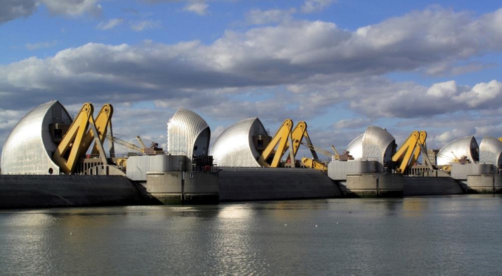
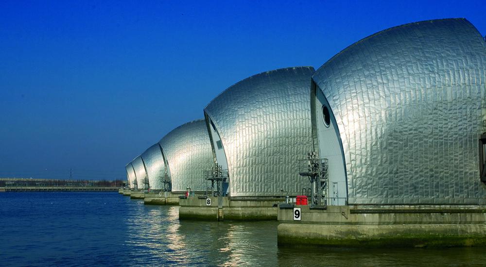
In 1968, we were commissioned to model how the construction and operation of a barrier at different sites would affect river levels, tidal currents, and siltation. Our work was crucial in developing the barrier design that we recognise today located at Woolwich Reach with its rising sector gates and four main spans, which are permanently open except during storm surges.
A novel approach to modelling
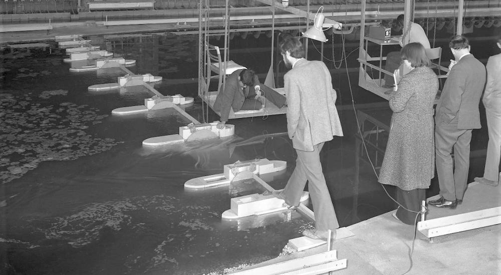
The team used a variety of models to help with the design, installation and maintenance of the barrier, many of which led to new innovations.
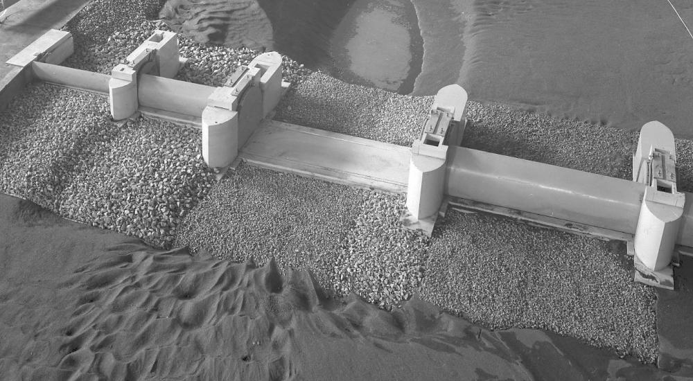
Six physical hydraulic models were built for testing between 1968 and 1978. The table below shows the models we built.
| Model | Horizontal scale | Vertical Scale | Estuary length reproduced |
| Thames Estuary | 1/600 | 1/60 | 100 km |
| Inflatable Barrier | 1/65 | 1/65 | 0.9 km |
| Silvertown Barrier | 1/300 | 1/60 | 70 km |
| Barrier Gate | 1/25 | 1/25 | 0.5 km |
| Bed Protection | 1/50 | 1/50 | 2.5 km |
| Outer Estuary | 1/1000 | 1/100 | 150 km |
The idea of an inflatable barrier may seem far-fetched, but it was intended as an approach to flood management in the period before the main Thames Barrier came into operation. In fact, it was considered feasible, but problems of anchorage and instability meant there was no cost saving compared to raising upriver flood defences, and it did not go ahead.
We also tested silt in the labs to help prevent silt accumulation, which has the potential to cause major issues for mobile barriers. For example, silt can become consolidated in the small gap between an open barrier gate and its housing, causing problems with opening and closing the gates.
This work resulted in the first ever mathematical model to reproduce the movement of suspended silt in an estuary. This was a major breakthrough for science at the time, and models descended from this one are now commonplace in maritime studies worldwide.
Field measurements of epic proportions
Our scientists and engineers launched a huge field campaign to inform and validate the modelling, and, during 1968 and 1969, they recorded the behaviour of the whole of the tidal Thames for the very first time.
Surveyors took to twelve boats positioned in mid-river simultaneously to undertake large-scale surveys for spring and neap tides, and for periods of high and low freshwater flow. They measured vertical profiles of current velocities, salinity, temperature and suspended sediment concentration every 30 mins throughout the tide.
The new measurements meant that the project engineers and scientists had a full picture of the behaviour of the tidal Thames under different tide and freshwater flow conditions. The data was vital to support the development and calibration of the mathematical modelling and to verify the reproduction of current velocity distribution, and salt water intrusion in the physical model.
Measuring sediment was a key part of the operation, with silt settling tests establishing the rate of deposition on the bed. The team also deployed six, long-term silt monitors to assess how suspended sediment concentrations varied in response to changing tidal, river flow, and meteorological factors. The measurements were used to understand sedimentation before, during and after construction of the Barrier.
40 years of service
The Thames Barrier was officially opened on 8th May 1984 and has been in continuous operation ever since. It is managed by the Environment Agency, which also oversees the other flood defences that make up the Thames tidal defences, including over 300 km of fixed defences (walls and embankments) and smaller tidal barriers.
Current projections of sea level rise show that barrier can continue to provide protection for London and the Thames Estuary until 2070. Plans for beyond 2070 are well underway.
The future of the Thames Barrier
In the early 2000s, the Environment Agency started on the Thames Estuary 2100 (TE2100) Plan, which outlines flood protection plans to the year 2100 and beyond. We worked closely with the agency to develop the plan, which includes adaptation of the flood defence system for climate change.
The Plan provides two options for what happens beyond 2070: either a replacement of the barrier with a new barrier further downriver; or improvements to the existing barrier so that it can resist higher water levels.
As sea level rises, the barrier will be required to close more often, meaning less time for maintenance. To reduce the number of barrier closures , the plan includes raising of the upriver flood defences through London.
However, as levels continue to rise, there will come a point where these defences just get too high. At this stage, the barrier could be replaced with a barrage, which would eliminate the threat of flooding caused by high tides. Current projections suggest that this may be needed during the 22nd century, well over 100 years from now.
The barrier’s legacy
The Thames Barrier demonstrated that barriers can protect major cities from tidal flooding, and it continues to attract international attention.
It has also set a high standard for design, and the iconic appearance of the barrier has become well-known and is highly praised. A particular feature of the barrier is the rising sector gates which are stored in gate sills on the river bed when the barrier is open. This avoids height restrictions for navigation and means that unsightly and tall structures for lifting gates are not needed.
The barrier and TE2100 projects have also provided a wealth of information on climate change adaptation and strategic planning for those involved in the inception and design of new and upgraded barriers.
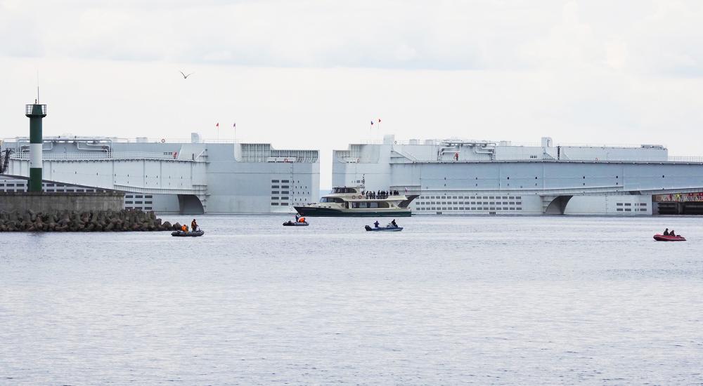
Since the Thames Barrier was completed, major new tidal barriers have been constructed which have drawn on the pioneering work in the Thames. Notable examples include the Maeslant Barrier in the Netherlands and the St. Petersburg Barrier, both designed to provide very wide navigation spans for busy commercial waterways, and the MOSE barriers near Venice, intended to have minimal impact on the skyline and landscape.
Tidal flood barriers: the future
As the sea level rises, the need for new tidal barriers will only increase. New structures are being considered at many locations around the world, including major cities on coasts and estuaries.
With each new barrier, there are new design and operational challenges including: designing for deeper water with higher currents and bigger waves, creating access for larger ships, ensuring barriers can adapt to climate change, and improving gate and lock technologies.
Barrier design must take account of the impacts on navigation, water flows and levels, erosion and sedimentation, water quality, salinity, land drainage and landscape impacts. Importantly, we also need a better understanding of how barriers affect the marine environment.
Collaboration will be the key to responding to these challenges and we are members of the I-STORM network, which brings together designers and operators of barriers from different countries. The network shares knowledge and experience of designing and operating barriers to reduce the risk of severe flooding to people, property and places
Certainly, barriers will be key component of climate change adaptation for coastal cities. At HR Wallingford, we continue to draw on our unique capabilities in science, technology and engineering to build on our long tradition of work in this important area.
Get in touch
Helen Wilcox