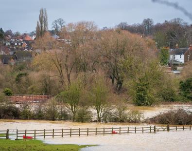
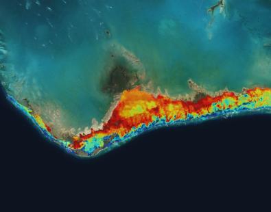
Developing more accurate river flood spatial data for Ireland
One of the benefits of having access to higher quality river flood data is that it will allow for improved flood risk assessment for areas outside those zones which have been designated as Areas for Further Assessment. This will be used to inform the second cycle PFRA and subsequent steps. What is more, the new data will also take renewed account of potential climate change impacts on flooding, in line with the Floods Directive.
Emma Brown, Principal Engineer in HR Wallingford’s Flood & Water Management Group, said: “Our work will involve undertaking a detailed hydrological assessment, building two-dimensional (2D) hydraulic models, and simulating multiple scenarios in order to generate more accurate flood spatial data.”
Conor Galvin, Project Manager, Office of Public Works, said: “This detailed hydrological evaluation and hydraulic modelling work is an important part of our ongoing Flood Risk Assessment. It will enable us to produce higher quality and therefore, more accurate, flood maps and information than was produced for the first assessment.”
More on flood risk management in Ireland
Work compiling the new river flood data is due to be completed by November 2019. More information on flood risk management in Ireland is available on the Office of Public Works dedicated website
Get in touch
Helen Wilcox