India: researchers to predict flood damage using satellite data
Working for the Met Office Weather and Climate Science for Service Partnership (WCSSP) India project and supported by the UK Government’s Newton Fund, specialists will use Earth Observation (EO) data from satellites to assess the likely impacts of flooding on buildings and farmland across the country. The results of the project are expected to inform the way similar challenges are tackled around the world.
Initially, the work will focus on three areas in Kerala, Southern India, which experienced devastating flooding during the monsoon rains in both 2018 and 2019. The 2018 Keralan floods led to hundreds of deaths, huge landslides, and temporarily displaced hundreds of thousands of people. The financial and livelihood costs were immense, with the Financial Times reporting an estimated US$2.7bn worth of damages to homes, roads and huge tracts of farmland.
Developed under the SIVA project (Satellites for Impact and Vulnerability Assessments), our new approach will assess damage from past floods using satellite data and combine it with the latest machine-learning techniques to build a complex model to predict future damage. Our expertise in solving complex water-related challenges is world-renowned and we have built similar tools using EO techniques to predict dam failures, dengue fever outbreaks and droughts.
“Scientific excellence and strong partnerships are at the heart of the WCSSP programme, and the expertise of HR Wallingford will advance understanding of the impacts of flooding in India, providing methodologies which will not only help predict damage from future flooding in India, but also have the potential to tackle similar challenges in other countries and regions of the world”, explains John Siddorn, WCSSP India Science Lead at the Met Office.
Quillon Harpham, principal scientist at HR Wallingford said: “HR Wallingford has been at the forefront of research into flooding for over 70 years, and we bring our knowledge and experience to help communities that are vulnerable around the world. We’re looking forward to applying our state-of-the-art Earth Observation techniques to help India to assess the potential damage from floods, which it can then use to plan how to increase protection and improve its response.”
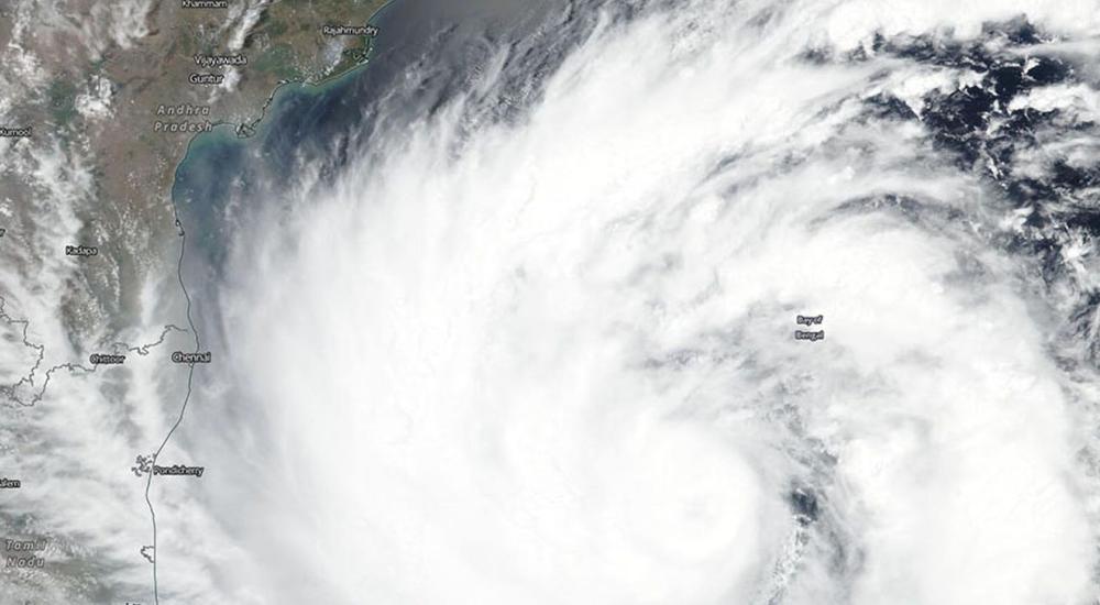
Main image: Super-Cyclone Amphan builds in the Bay of Bengal - ©2020 NASA Worldview, Earth Observing System Data and Information System (EOSDIS).
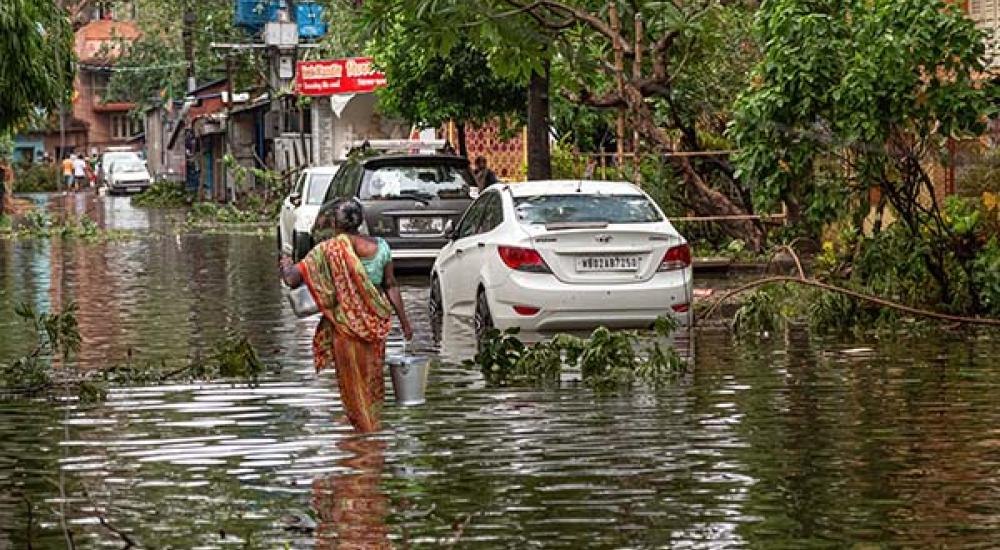
News gallery image: iStock.com/Roop_Dey
Get in touch
Helen Wilcox