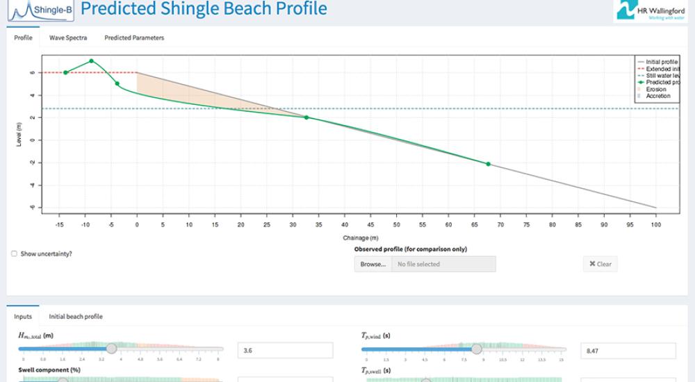
Shingle B: the online tool helping to monitor and protect shingle beaches
Shingle beaches have received much less attention from the research community than sandy beaches, with the result that fewer modelling tools exist to predict changes on shingle beaches. Funded by an Environment Agency flood and coastal erosion risk management grant, New Forest District Council commissioned HR Wallingford, in collaboration with the Channel Coastal Observatory, to develop a shingle beach profiling tool which can also account for wave conditions which include swell.
Mobile by nature, shingle beaches are typically steep, and come in many different forms including spits, fringing pocket beaches and barriers, and barrier islands. As the incoming waves easily seep through the coarse, porous surface of a shingle beach, this reduces the impact of the erosion caused by the retreating waves, leading to sediment deposition which forms a steeply sloping beach.
On a typical shingle beach, large material is deposited at the back during periods of high energy waves, such as during a storm, with minor ridges forming at lower elevations indicating the levels of lesser storms or lower tides. Many shingle barrier systems are also undergoing major change due to rising sea levels, which tend to move shingle inland as wave action pushes it to the top of the beach. Major storms overtop the structure carrying shingle over and initiating gradual rollover migration.
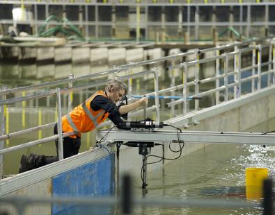
Dr Tim Pullen, Principal Engineer in Coastal Structures at HR Wallingford, said: “In this research, we examined the profile response of gravel beaches to bi-modal wave spectra, carried out by swell and wind wave periods in various combinations. To gather the data to inform the model, we carried out an extensive 2D flume study in a 100m long, 1.8m wide and 2m deep wave flume at our physical modelling laboratories in Oxfordshire.”
The Shingle B tool, which has just celebrated its first anniversary, was made publicly available online in July 2016 on the Channel Coastal Observatory website as an open-source tool, freely available worldwide for use by coastal engineers and engineering consultants. Since its launch, the tool’s web page has already received over 7,000 visitors.
Dr Travis Mason, Director of the Channel Coastal Observatory, said: “The rapid morphological changes of shingle beaches under wave action makes their monitoring and management a continual challenge. The research undertaken by HR Wallingford has provided a new model to allow for more precise modelling of shingle profile changes under complex sea conditions. The development of Shingle-B provides us with a unique, easy-to-use tool, to assist with the prediction of the likely changes to specific shingle beaches, and so help in their operational management.”
The results of the 2D physical model study, ‘Prediction of Gravel Beach Storm Profiles under Bimodal Sea states’ were recently presented at The International Society of Offshore and Polar Engineers conference (ISOPE 2017) in San Francisco by Andrea Polidoro, Coastal Structures Engineer at HR Wallingford.
Get in touch
Helen Wilcox