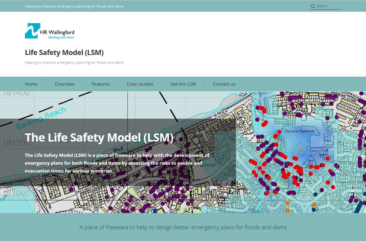
Life Safety Model
The Life Safety Model (LSM) can help with the development of emergency plans for both floods and dams by assessing the risks to people and evacuation times for various scenarios. The LSM represents the behaviour of each individual person, vehicle and building and their interactions with the floodwater.
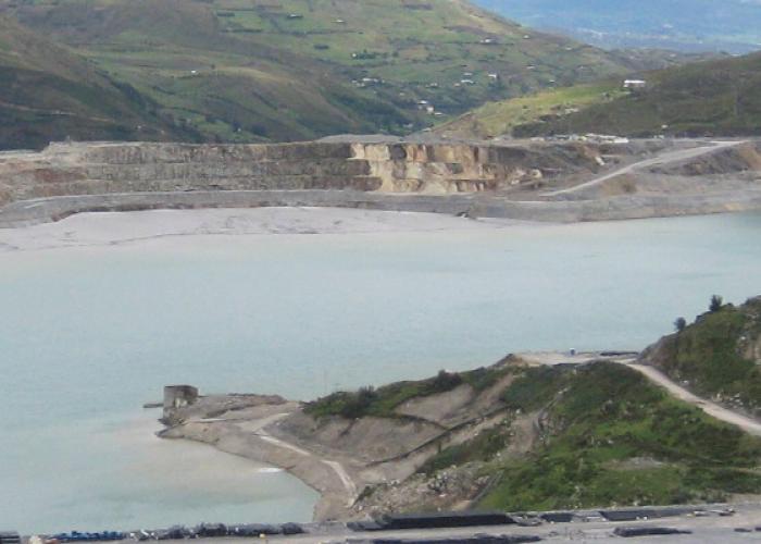
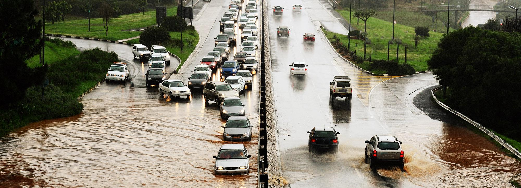
There are tens of thousands of large dams worldwide and millions of kilometres of defences protecting people from floods. Although the chance of one of these failing is relatively low, the consequences can be deadly. In 2019, the failure of the Brumadinho tailings dam in Brazil led to around 300 fatalities.
Planning for these catastrophes in advance can help authorities to understand where the risks to people are the highest, and help to reduce the number of fatalities. Even issuing a warning a few minutes before a dam breaks or a major flood occurs can save a significant number of lives.
Used worldwide to inform and improve emergency plans
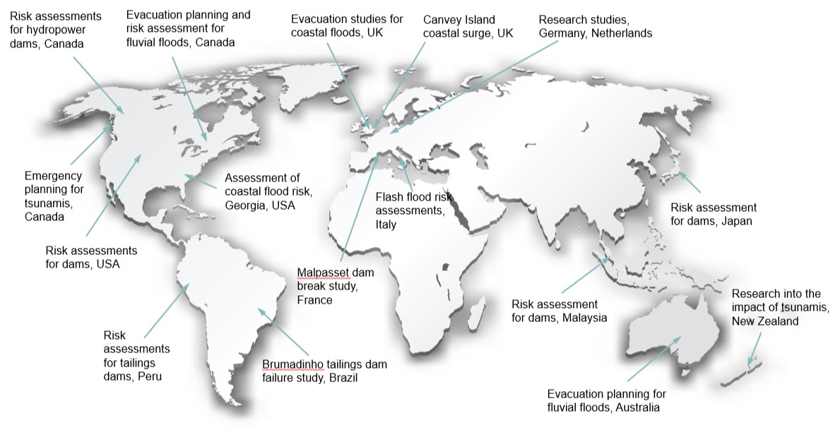
The LSM has been used worldwide to inform and improve emergency plans for both dams and floods, as well as providing evidence-based estimates of the risks these pose to people in terms of loss of life and injuries. Recently, dam owners in Canada have used the LSM to check and implement safety upgrades to large dams, as well as develop emergency plans. In Malaysia, the LSM has been used to inform authorities of how much time they have available to evacuate people in the event of a dam break, and the results are being used in improved emergency planning exercises. Work is currently ongoing in Peru with the LSM helping the government understand the risks posed to people by dams that store mining waste.
How does the LSM work?
The Life Safety Model (LSM) uses a dynamic representation of the flood wave that would result from a dam break or an extreme flood and combines this with digital depictions of each individual people, building and vehicle. This is known as an agent-based model. The LSM allows users to view animations of the consequences of a dam break and flood as they unfold. More importantly, the LSM provides information to emergency planners that means they can assess when to issue warnings, where to locate areas where people will be safe from the floodwater, how to manage traffic and when to order the evacuation of different communities. The LSM also provides flood risk managers with evidence-based estimates of loss of life and injuries for a range of flood scenarios and the means to investigate how these can be reduced.
Screenshots
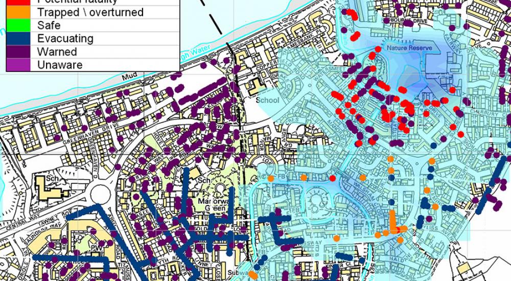
Output from the Life Safety Model showing the potential fatalities and injuries.
Ordnance Survey © Crown Copyright 2002. All rights reserved. HR Wallingford licence number 100019904.
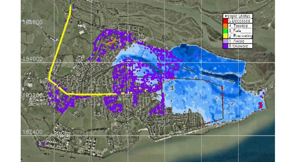
Screenshot of the Life Safety Model showing the potential fatalities and evacuation routes.
The LSM is based on 20 years of research, initially by BC Hydro in Canada and over the past decade by HR Wallingford. The LSM is regularly improved and updated. The latest version includes additional life loss mechanism for buildings affected by high water levels, more detailed representations of refuges and safe havens, as well as an improved traffic flow model. We have published a number of peer reviewed articles on the LSM and we have validated the model using a number of historical floods and dam break events worldwide.
Visit the Life Safety Model website
Want to know more?