Malaysia raises the bar for tropical flood forecasting
Malaysia is implementing a state-of-the art national flood forecasting system, which alerts authorities 48 hours prior to a flood and can forecast flooding a week in advance. The move, which could save many lives, is the first time national-scale flood management has been implemented in a harsh tropical environment. As the rollout continues across the country, Emma Brown takes a look at Malaysia’s complex relationship with flooding and how the national system will benefit the South East Asian country.
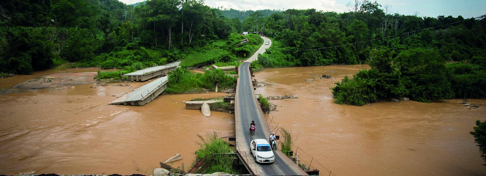
The move to unify the technological approach to flood management across Malaysia is important, as a fifth of the country’s population is estimated to be at risk from flooding. Large areas of the country repeatedly suffer from prolonged, significant floods; these cause widespread disruption for communities, business and critical infrastructure, often requiring many tens, or even hundreds, of thousands of people to be evacuated from affected areas. The impact of flooding has been made worse over the past decade by rapid urban growth and land use change, as these developments have modified the rivers’ flow regimes and flooding mechanisms.
Situated near the equator, Malaysia’s humid tropical climate brings an average of 2.5 metres of rainfall per year to the Peninsula, while in some parts of East Malaysia, on the island of Borneo, totals have been known to exceed 4 metres. What is more, the majority of the rain falls during the North East monsoon, typically between November and March, and has its biggest impact on the Peninsula’s east coast and East Malaysia. Meanwhile, the inter-monsoon period brings thunderstorms and flash flooding to the west coast, notably the capital city Kuala Lumpur. Here, the urban population of 8 million is densely packed, and the stormwater drainage channels often cannot cope with the rainfall intensities, so that the impacts can be huge.
Malaysia’s Department of Irrigation and Drainage has wholeheartedly embraced a modern ‘non-structural’ approach to flood management, with the development of its world-leading National Flood Forecasting and Warning System (NaFFWS). The system is the result of many decades of hard work installing a network of over 700 observation gauges across tricky terrain, including dense rainforest. Already successfully trialled in three catchments in Malaysia, the scheme has now been broadened to 11 more river basins in the north-west of the country, and 11 further catchments on the east coast, by local consultants in partnership with developers of the system’s core, HR Wallingford; before further extensions take it to the remaining part of peninsular and eastern Malaysia.
NaFFWS is based upon a three-stage process. First, engineers set up the system by gathering historical rainfall and flow data as well as creating models of the runoff, river channels and flood plains; Second, the data is combined with weather forecasts and on-the-ground measurements to predict water levels; finally, the system is set to run operationally and continuously, with forecasts and warnings automatically generated.
Typically, automatic simulations are carried out several times a day to forecast water levels and flows in the river channels, and to map the flood inundation process within the flood plains. Hydrological rainfall-runoff models represent the upper catchments, running in continuous simulation mode in order to keep their internal states updated and representative of current conditions. These feed the boundaries of 1D and 2D hydrodynamic models, which model the flows in the river channels, and simulate the movement of water in the flood plains.
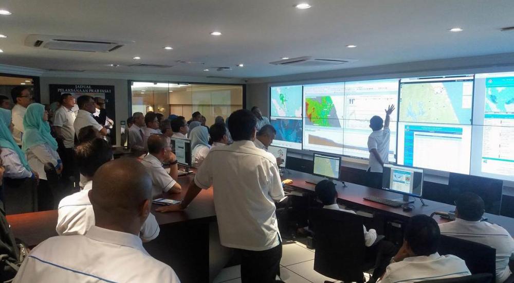
Warnings are sent to a national control centre at the Department of Irrigation and Drainage, so they can take immediate action. On the ground, a number of different agencies work to provide information and support to the various front-line response organisations. But, with around 60% of the population able to access the internet or having a smartphone, direct flood warnings to the public are also available.
Developing and maintaining systems such as NaFFWS requires significant commitment at all levels, from senior government to technical experts and frontline emergency responders. But the drivers for more effective flood forecasting and warning systems are clear. The UN Economic and Social Council estimates that average annual loss due to flooding in the Asia Pacific region is US$86 billion, and in its 2014 South-East Asia report on disaster-induced displacement, the Internal Displacement Monitoring Centre states that ‘improvements in life-saving early warning systems and evacuation planning means that more people are expected to survive disasters even as their homes are destroyed’.
HR Wallingford has have been involved with the design of flood management schemes for over 70 years, and brings its knowledge and experience to help communities that are vulnerable to flooding around the world. For instance, the team has also developed state-of-the-art technology for Ireland’s national indicative fluvial mapping programme, as well as systems for England and Moldova.
No government can entirely eliminate the risks of such disasters, but technology, coupled with political will, can reduce them. Certainly, the nationally consistent approach to flood management in Malaysia has really raised the bar for early-warning systems, especially in difficult environments. And with climate change and urbanisation expected to lead to bigger and more frequent floods worldwide, such systems are set to become all the more important.

Want to know more?