
Secondary nav 2022

  • Equipment
  • Software
  • Training

Main navigation 2022

  • About
    • About HR Wallingford
    • Our leadership
    • Our people
    • Our impact
      • Annual report & financial statements
      • Gender pay
      • Social impact
      • Sustainability
    • Our story
    • News
    • Insight articles
    • Policies
  • Projects
  • Expertise
    • Coastal & marine sustainability
      • Coastal hazards & resilience
      • Coastal morphology & sediment dynamics
      • Dredging and sediment management
      • Marine & coastal environment
      • Ports, harbours and shipping
      • Subsea engineering
      • Waterfronts, marinas and resorts
    • Energy transition
      • Fixed offshore wind
      • Floating offshore wind
      • Liquified gas & transition fuels
      • Nuclear
      • Wave, tidal, solar & hydropower
    • Water & climate resilience
      • Dams & reservoirs
      • Freshwater environment
      • Integrated flood management
      • Surface water systems
      • Water management for climate resilient development
      • Water supply & drought resilience
  • Facilities
    • Explore our facilities
    • Ship simulation
      • Australia Ship Simulation Centre
      • UK Ship Simulation Centre
    • Physical modelling
      • Fast Flow Facility
      • Tsunami simulator
      • Volumetric flow flume
      • Wave basins
      • Wave flumes
      • Erosion rate measurement
      • Water rescue training
  • Careers
    • Careers overview
    • Working at HR Wallingford
    • Job opportunities
  • Contact
  1. Home >
  2. Projects >
  3. Using satellite data to evaluate the impact of severe weather in India

Using satellite data to evaluate the impact of severe weather in India

Share
Flooded fields in west bengal

We have developed new methods that use satellite earth observation data to evaluate the impact of severe weather across India. 

Wide-ranging impacts

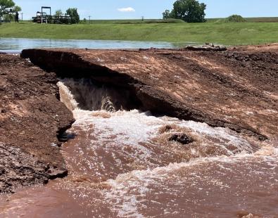
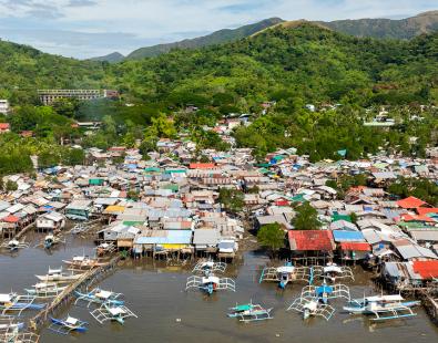
Every year in India, climate-related hazards cause large loss of life and damage to property, as well as critical infrastructure. Between 1995 and 2015 some 805 million people in India were affected by weather-related hazards. A 2017 report put India among the 10 most disaster-prone countries in the world and ranked floods as the climate-related hazard posing the greatest risk to people. Guidance issued by the World Meteorological Organisation in 2015 strongly recommended the development of monitoring tools, capabilities and networks to verify forecasts and warnings of the impact that natural hazards will cause. 

Delivering consistency

Impact assessments are usually informed by on-the-ground observations and reports from a variety of sources, but the lack of structure and consistency of methodology makes it difficult to compare across events. It can also be difficult to determine the impact of large events with a wide spatial scale or events with a dynamic time component.

As part of the Satellites for Impact and Vulnerability Assessment (SIVA) project, we explored how satellite remote sensing can be used to consistently identify and quantify some of the impacts of severe weather in India.

Satellite remote sensing data offers a consistent source of information with up to global coverage. It can be used to observe large spatial areas and situations evolving over time. We developed a set of methods to show the capability of satellite data to identify and classify the impacts of floods and high winds. This includes:

  • Inferring the impact of a flood on the road network and creating algorithms for assessing changes of road access to critical infrastructure during a flood;
  • Calculating population whose villages are cut off by flood waters;
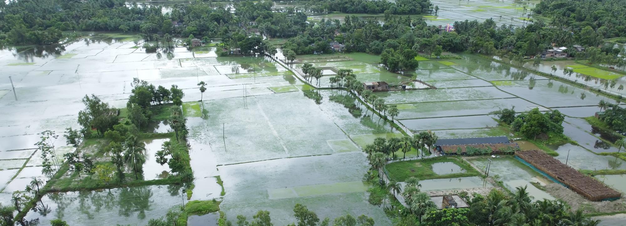
  • Building a new method for assessing the impact of a flooding on crops; 
  • Building a new method for assessing the impact of a high winds on orchards.

By developing these specific examples, SIVA has improved our overall understanding of the nature of ‘impact’ and how it should be represented.
 

Enhanced emergency management

The methods we developed on the SIVA project are an important step to building new weather and climate services capable of forecasting and evaluating, not only the natural hazard itself, but the impact that the natural hazard will cause. These resultant services will allow key stakeholders to make informed decisions as to the most effective emergency management strategies for severe weather; they will contribute to national and local disaster risk reduction strategies; and will help to reduce the damage caused by high-impact weather.

SIVA was funded by the Met Office Weather and Climate Science for Service Partnership (WCSSP) India project, and was supported by the UK Government’s Newton Fund.

Contact our project lead

Barbara Hofmann

Principal Earth Observation Scientist
Contact Profile

Explore more

  • All
  • Project
  • Expertise
  • News
  • Insight
  • Facility

Drainage and Wastewater Management guidance

Rainwater Management Platform: transforming how the UK manages rainwater

SuDS iQ: a digital environment for evaluating and planning good SuDS

View of a dam breach experiment

Dam and levee models assessed for predicting internally initiated breaches

View of a dam breach experiment

Dam and levee models assessed for predicting internally initiated breaches

View of a dam breach experiment

Dam and levee models assessed for predicting internally initiated breaches

dolphin swimming next to big ship

SEUSS, innovative modelling to safeguard marine ecosystems worldwide.

Buscot Park lake: a heritage dam reinvented

Automating biodiversity impact assessments with Earth observation

Aerial view of a meandering river

A new Environmental Destination framework

view of people helping during a flood event

Empowering communities to manage local flood risk

Flood early warning system to support tropical cyclone relief

We are global leaders and independent experts in how to live and work sustainably with water

Social media

  • BlueSky
  • LinkedIn
  • YouTube

Expertise

  • Coastal & marine
  • Energy transition
  • Water & climate
  • Software solutions
  • Equipment & technology

Company

  • About
  • Careers
  • News
  • Insights
  • Sustainability

Legal

  • Privacy & data protection
  • Policies
  • Modern slavery statement
  • Terms & conditions
  • Sitemap
© 2026 HR Wallingford
Contact