
Secondary nav 2022

  • Equipment
  • Software
  • Training

Main navigation 2022

  • About
    • About HR Wallingford
    • Our leadership
    • Our people
    • Our impact
      • Annual report & financial statements
      • Gender pay
      • Social impact
      • Sustainability
    • Our story
    • News
    • Insight articles
    • Policies
  • Projects
  • Expertise
    • Coastal & marine sustainability
      • Coastal hazards & resilience
      • Coastal morphology & sediment dynamics
      • Dredging and sediment management
      • Marine & coastal environment
      • Ports, harbours and shipping
      • Subsea engineering
      • Waterfronts, marinas and resorts
    • Energy transition
      • Fixed offshore wind
      • Floating offshore wind
      • Liquified gas & transition fuels
      • Nuclear
      • Wave, tidal, solar & hydropower
    • Water & climate resilience
      • Dams & reservoirs
      • Freshwater environment
      • Integrated flood management
      • Surface water systems
      • Water management for climate resilient development
      • Water supply & drought resilience
  • Facilities
    • Explore our facilities
    • Ship simulation
      • Australia Ship Simulation Centre
      • UK Ship Simulation Centre
    • Physical modelling
      • Fast Flow Facility
      • Tsunami simulator
      • Volumetric flow flume
      • Wave basins
      • Wave flumes
      • Erosion rate measurement
      • Water rescue training
  • Careers
    • Careers overview
    • Working at HR Wallingford
    • Job opportunities
  • Contact
  1. Home >
  2. Training >
  3. River modelling & drainage design for flood risk assessment & management

River modelling & drainage design for flood risk assessment & management

Share
River modelling and drainage design for flood risk assessment and management

This course will benefit those responsible for reviewing hydrological estimation and river modelling outputs as part of Flood Risk Assessments, and for evaluating and approving conceptual drainage designs and surface water management plans for new developments. It helps participants understand the fundamental hydrological and hydraulic modelling issues necessary for the delivery of robust flood risk and drainage impact assessments / conceptual drainage designs. 

Duration
Two days
Type
Training course
Select variants
No course dates are currently available
Register interest

This course is targeted at local authorities, with the objective of helping participants understand the fundamental hydrological and hydraulic modelling issues necessary to undertake a robust review of flood risk model outputs and surface water drainage design submissions for planning. Current software facility and visualisation tools can often enhance understanding but can also lead to a reduced reliance on technical appreciation; and to rigorous model schematisation, parameterisation and numerical model output checks being overlooked.

Content

The course will cover:

  • the latest UK flood estimation procedures and hydraulic modelling processes for assessing site-specific flood risk;
  • the latest UK runoff estimation procedures for development sites, and approaches to SuDS and conceptual drainage design.

A key focus will be on developing an understanding of the necessary review processes and review elements to ensure that the modelling represents the correct hydrological and hydraulic processes; that model inputs are appropriate and sufficiently accurate; that model outputs look sensible and usable; and that the process follows best practice guidance.

The course does not provide training in or reference to specific proprietary pieces of modelling software and associated parameters. Instead, the focus is on generic model concepts, objectives and outputs.

The course principles will be communicated via a series of presentations supported by a series of linked delegate exercises. Exercises on SuDS implementation will use the tools on the uksuds.com website.

Who should attend?

Those responsible for reviewing river modelling outputs as part of flood risk assessment and surface water conceptual drainage design submissions for planning.

Learning outcomes

At the end of the course participants will have:

  • an understanding of UK flood estimation best practice, challenges and uncertainties; 
  • an understanding of which types of hydraulic model are appropriate for different situations;
  • a comprehension of issues such as the spacing of river cross-sections, the location of boundary conditions, and the importance of calibration, validation and verification;
  • an understanding of the main sources of uncertainty and how these can be considered as part of the flood risk assessment review;
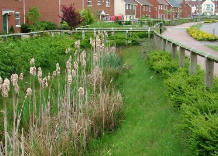
  • an appreciation of current surface water management design criteria, SuDS delivery objectives, greenfield and development site runoff and storage volume estimation methods, key approval issues; 
  • an overview of the importance of quality assurance, check lists, and audit trail techniques.

Really well presented and explained, very knowledgeable presenters.

Past delegates

Course leaders

Caroline Hazlewood

Director of Water and Climate
Contact Profile

FAQs

More information about travel and accommodation, booking and confirmation and more.

Read more

Course login

Access joining instructions, course materials and course certificates inyour secure course area.

Login

Get in touch

Sarah Moxon

Events & Publications Coordinator
Contact

Related courses

SuDS: standards, guidance and design tools
warning sign of flooded road
QGIS for flood risk management

We are global leaders and independent experts in how to live and work sustainably with water

Social media

  • BlueSky
  • LinkedIn
  • YouTube

Expertise

  • Coastal & marine
  • Energy transition
  • Water & climate
  • Software solutions
  • Equipment & technology

Company

  • About
  • Careers
  • News
  • Insights
  • Sustainability

Legal

  • Privacy & data protection
  • Policies
  • Modern slavery statement
  • Terms & conditions
  • Sitemap
© 2026 HR Wallingford